










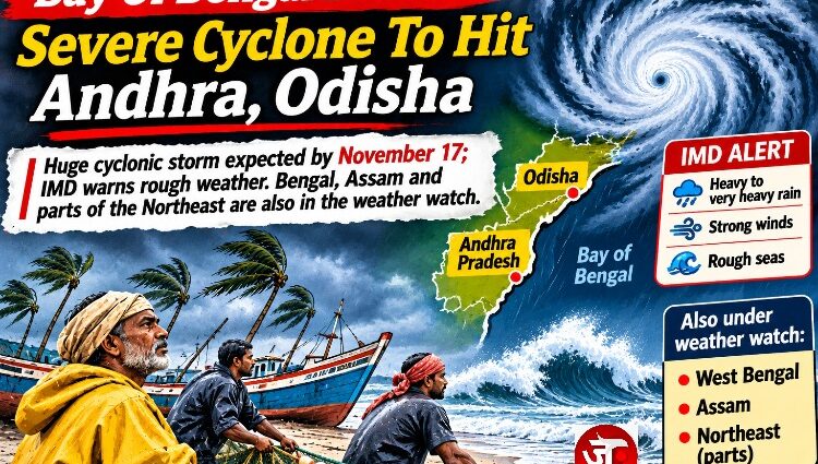
Huge cyclonic storm expected by November 17; IMD warns rough weather. Bengal, Assam and parts of the Northeast are also on the weather watch.
MONDAY, NOVEMBER 16, 2026
The Bay of Bengal is preparing to unleash another powerful weather system, with a depression over its southeast and adjoining southwest regions forecast to intensify into a cyclonic storm named Cyclone Akvan, on November 16 and a severe cyclonic storm by November 17.
The India Meteorological Department (IMD) has warned that the system is likely to move north-northwestwards, strengthen further and head towards the Andhra Pradesh coast over the following two days.
This could become the third major cyclonic storm to threaten India’s eastern coastline in just three weeks, following Cyclone Arnab and Cyclone Murasu.
The developing storm has put coastal states on alert, with the possibility of extremely heavy rainfall, damaging winds, rough seas and disruption to fishing, agriculture and transport.
But the impact may not stop at the coastline. Weather forecasts indicate that parts of eastern and northeastern India could also experience rainfall and thunderstorms over the coming days.
ANDHRA PRADESH: THE BIGGEST IMMEDIATE CONCERN
Andhra Pradesh is among the most vulnerable states as the system moves towards its coastline.
According to the IMD’s November 15 bulletin:
- November 18: Heavy rainfall is likely at isolated places along coastal Andhra Pradesh.
- November 19–20: Heavy to very heavy rainfall is expected at several places, with isolated extremely heavy rainfall.
- Strong winds are likely along the coast as the cyclone approaches.
The IMD has forecast maximum sustained winds of 120–130 kmph, with gusts reaching 145 kmph, during the system’s subsequent intensification.
Coastal communities, fishing settlements, farmers and local authorities will need to prepare for possible flooding, damage to infrastructure and disruption of essential services.
However, the precise landfall location has not yet been established. The cyclone’s track remains crucial in determining which districts will face the worst conditions.
ODISHA: ANOTHER ROUND OF CYCLONE ANXIETY
Odisha is also preparing for another spell of severe weather. The state has already experienced significant damage from recent cyclones, and another approaching system raises concerns about vulnerable coastal settlements, agricultural losses and infrastructure.
The IMD forecasts:
- November 18: Isolated heavy rainfall.
- November 19–21: Widespread rainfall, with isolated very heavy rainfall.
- November 19–21: Thundersqualls with winds reaching 50–60 kmph and gusts up to 70 kmph are possible.
The possibility of another severe weather event is particularly concerning for farmers whose crops and livelihoods have already suffered during the recent cyclone season.
TAMIL NADU: HEAVY RAINS AND THUNDERSTORMS
Tamil Nadu is also expected to experience the influence of the developing system.
The IMD has forecast isolated heavy rainfall during November 17 and 20, with very heavy rainfall possible on November 18 and 19.
Thunderstorms, lightning and gusty winds reaching 40–50 kmph, with gusts up to 60 kmph, are also likely during November 18–20. The amount of rainfall Chennai and northern Tamil Nadu receive will depend significantly on the cyclone’s eventual track.
Meteorologists have cautioned that landfall predictions remain uncertain and should not be treated as final.
WILL WEST BENGAL BE AFFECTED?
Yes. West Bengal is included in the IMD’s rainfall forecast, although its expected impact is different from that of Andhra Pradesh and Odisha.
The IMD has forecast:
- November 18: Isolated rainfall in Gangetic West Bengal.
- November 19–20: Isolated heavy rainfall and thunderstorms.
- November 21: Further isolated rainfall and gusty winds.
The Sub-Himalayan region of West Bengal and Sikkim has a separate forecast of isolated rainfall on November 15–16, with predominantly dry conditions thereafter in the seven-day forecast.
This distinction matters. Gangetic West Bengal faces a more significant rainfall window later in the week, while the northern districts are not currently under the same rainfall warning.
WHAT ABOUT ASSAM AND THE NORTHEAST?
The Northeast is not expected to face the cyclone’s direct coastal impact, but parts of the region are forecast to receive rain. The IMD’s November 15 bulletin provides the following outlook:
Assam and Meghalaya: Isolated rainfall on November 16, followed by another spell of isolated to scattered rainfall during November 19–21.
Arunachal Pradesh: Isolated to scattered rainfall is forecast through November 21.
Manipur, Nagaland, Mizoram and Tripura: Rainfall is expected during November 18–21, with isolated thunderstorms and lightning in parts of the region.
Mizoram and Tripura: Isolated heavy rainfall is forecast on November 19.
Importantly, the IMD has also identified an upper-air cyclonic circulation over Northeast Assam and another over Sub-Himalayan West Bengal. These are separate atmospheric features mentioned in the bulletin.
There is currently no indication of a direct severe-cyclone threat to Assam, Meghalaya, Manipur or the other northeastern states. Nevertheless, residents should follow local weather warnings, particularly where thunderstorms and heavy rainfall are forecast.
WHAT ABOUT NORTH INDIA?
The northern states are not currently in the cyclone’s principal impact corridor.
The IMD’s forecast does not indicate a significant cyclone-related rainfall threat over Delhi, Punjab, Haryana, Rajasthan, Himachal Pradesh, Uttarakhand, Jammu and Kashmir or Ladakh during the main period of the storm’s development.
However, a separate Western Disturbance is present over northern parts of the subcontinent. The weather department has also warned of dense fog in parts of Uttar Pradesh during November 15–17.
Therefore, northern India is dealing with a different set of weather conditions rather than the direct effects of the Bay of Bengal cyclone.
FISHERMEN WARNED: THE SEA IS TURNING DANGEROUS
One of the most immediate concerns is the deterioration of sea conditions.
The IMD has warned of increasingly rough to very rough seas, with conditions expected to become high to very high over parts of the Bay of Bengal. Wind speeds are also forecast to rise substantially as the system strengthens.
Fishermen have been advised to return to the coast and avoid venturing into the affected sea areas during the specified warning periods.
Authorities and coastal administrations must remain alert to the possibility of dangerous waves, strong winds and disruption to fishing activity.
THE BIGGER PICTURE: ANOTHER CYCLONE IN THREE WEEKS
The developing system comes after Cyclone Arnab struck the Andhra Pradesh coast on October 27 and Cyclone Murasu crossed the coast between Nellore and Narasapur on November 3.
The two previous storms caused significant damage, including destruction of crops, infrastructure and power networks.
Preliminary estimates placed the damage from Cyclone Murasu at approximately ₹1,919.59 crore, affecting more than 1.86 lakh farmers.
The prospect of another powerful storm raises serious questions about the vulnerability of coastal communities and the ability of farmers to recover from repeated weather disasters.
For families already struggling with damaged homes, lost crops and mounting debts, another cyclone could mean another devastating setback.
The question now is not just where the cyclone will make landfall, but how well india is prepared to protect the people who will be in its path.
The next 48–72 hours will be crucial in determining the storm’s intensity, movement and eventual impact.
Source: India Meteorological Department (IMD), press release dated November 15, 2026, and subsequent regional weather bulletins.
JANPATH NEWS NETWORK (JNN)
Independent. Fearless. On the People’s Path.